BIKE

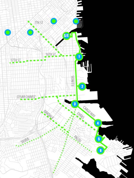
There are several shops that rent bikes around SOMA, Hayes Valley and the northern waterfront. Several bike routes connect in to the suggested route along the
Blue Greenway Trail
SUGGGESTED BIKE LOOP | 11 miles | ~1 hr
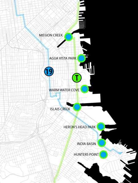
Leg 1: Mission Creek - Agua Vista Park - 8 min (1.3 mi)
Leg 2: Agua Vista - Warm Water Cove - 5 min (1.0 mi)
Leg 3: Warm Water Cove - Islais Creek - 5 min (0.9 mi)
Leg 4: Islais Creek - Heron's Head Park - 6 min (1.0 mi)
Leg 5: Heron's Head Park - India Basin - 7 min (1.2 mi)
Leg 6: India Basin - Hunters Point - 7 min (0.8 mi)
Leg 7: Hunters Point - Mission Creek - 25 min (4.8 mi)
Loop: ![]()
Dedicated Bike Lanes: ![]()
Shared Roads: ![]()
Bike Rental Locations: ![]()
WALK/TRANSIT

All of the sites are located within a short walk of public transportation.
FROM BART/MUNI DOWNTOWN:
Take the T from Embarcadero Station toward Sunnydale
Transfer at Evans Station for the 19 bus toward Navy
Other lines serving the Southeast Waterfront include the 10, 22, 23, 24, 29, 44, 48, 54
BOAT

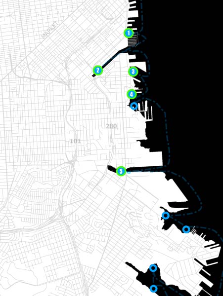
These locations provide a place to launch
human-powered craft. Pier 52 is the only public
launch and provides access for motorized boats.
EXISTING AND PROPOSED
WATER CRAFT LANDINGS
1. Pier 40
2. Mission Creek
3. Pier 52 Public Boat Launch
4. Pier 66 Boatyard
P - Crane Cove Park
5. Islais Landing
P - Shoreline Park
P - Hunters Point Shipyard Redevelopment
P- Yosemite Basin

